Introduction
3D scan and photogrammetry software reconstructs geometry and textures from overlapping images and/or 3D scanner data, producing dense point clouds, meshes, and textured models. Modern platforms often combine GPU‑accelerated photogrammetry with LiDAR or structured‑light scans, enabling high‑resolution results even on large or complex scenes.
Typical use cases include drone mapping for construction and mining, reality capture for architecture and BIM, digital twins of industrial assets, cultural heritage documentation, game and film asset creation, and product digitization for 3D printing. When evaluating tools, users should weigh core capabilities (image and scan processing, accuracy, scaling), supported data types (drone imagery, terrestrial photos, LiDAR), automation, integration with GIS/CAD/3D tools, licensing model, and vendor support.
Best for: 3D scan and photogrammetry platforms are ideal for surveyors, civil engineers, drone pilots, VFX and game artists, industrial and product designers, cultural heritage teams, and enterprises building digital twins or large mapping programs. They suit organizations from small studios to large construction and infrastructure firms that need repeatable, metric‑accurate 3D outputs.
Not ideal for: Teams that just need simple 3D viewers, basic AR previews, or generic 3D modeling may be better served by lightweight modeling or CAD tools rather than full photogrammetry suites. Extremely budget‑constrained users with only occasional needs may prefer free or open‑source options, or outsourcing scanning work.
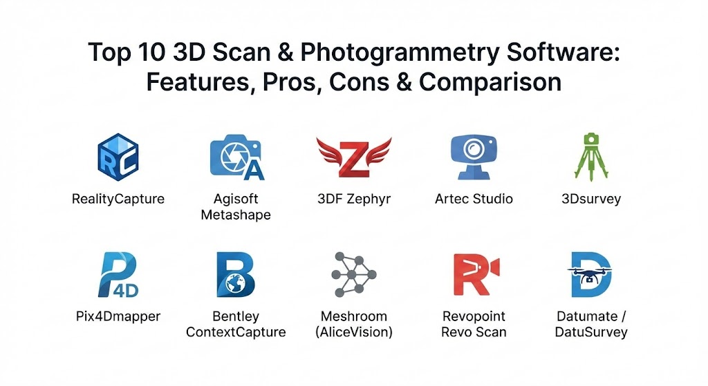
Top 10 3D Scan & Photogrammetry Software Tools
The tools below blend high adoption, strong expert reputation, and current relevance in 2025.
1 — RealityCapture
Short description: RealityCapture is a high‑performance photogrammetry engine focused on turning large photo and laser‑scan datasets into detailed 3D models at exceptional speed. It targets professionals in VFX, surveying, mapping, and cultural heritage who need fast, high‑quality reconstructions.
Key features
- GPU‑accelerated alignment and reconstruction tuned for massive datasets.
- Support for mixed sources: DSLR images, drone imagery, and laser scans.
- Advanced mesh generation, texturing, and reprojection tools.
- Integration with Unreal Engine for real‑time visualization and virtual production.
- Ground control point workflows for survey‑grade outputs.
- CLI and scripting capabilities for pipeline automation.
- Flexible licensing options tailored to project scale.
Pros
- Extremely fast processing compared with most alternatives, especially on large jobs.
- High‑quality, detailed meshes suitable for demanding visualization and mapping work.
- Strong fit for studios and survey teams that prioritize throughput and production pipelines.
Cons
- Steeper learning curve for new users, especially around advanced settings.
- Windows‑centric and hardware‑intensive for peak performance.
- Pricing can be significant for very large or continuous workloads.
Security & compliance
- Primarily a locally installed application; data typically stays on user infrastructure.
- Enterprise security certifications and SSO are not front‑and‑center; compliance posture is best treated as “Varies / N/A” and validated via vendor documentation.
Support & community
- Professional documentation and tutorials, with active community discussions in survey, VFX, and game‑dev circles.
- Commercial support available through the vendor; integration know‑how widely shared in Unreal and 3D communities.
2 — Agisoft Metashape
Short description: Agisoft Metashhape (formerly PhotoScan) is a mature, widely used photogrammetry suite prized for its balance of accuracy, user control, and perpetual licensing. It serves surveyors, researchers, cultural‑heritage experts, and content creators.
Key features
- End‑to‑end pipeline from alignment to dense point cloud, DSM/DTM, orthomosaics, and textured meshes.
- Cross‑platform support (Windows, macOS, Linux) with advanced processing options.
- Ground control, markers, and georeferencing for survey‑grade results.
- Scripting via Python for automation and batch workflows.
- Tools for multispectral and thermal imagery, plus stereographic outputs.
- One‑time license with optional paid upgrades instead of mandatory subscriptions.
- Good interoperability with GIS, CAD, and 3D software via standard export formats.
Pros
- Reliable, repeatable results with strong geometric accuracy in independent studies.
- High degree of control over processing parameters for scientific or specialist use.
- Perpetual licensing appeals to organizations that prefer ownership over subscriptions.
Cons
- Slower than RealityCapture on large datasets, especially dense reconstruction stages.
- Can be resource‑intensive, needing substantial RAM for high‑resolution projects.
- UI feels more technical and less guided for absolute beginners.
Security & compliance
- Desktop‑centric, with processing done locally; this is attractive for sensitive or regulated data.
- No heavily marketed enterprise compliance stack; treat as “Varies / N/A” and govern via your own security controls.
Support & community
- Long‑standing user base, active forums, and community scripts and workflows.
- Documentation is detailed but slightly more technical; commercial support available through Agisoft.
3 — 3DF Zephyr
Short description: 3DF Zephyr is a commercial photogrammetry package with an accessible interface and strong drone and survey workflows, including laser‑scan support. It caters to engineers, surveyors, and creative professionals seeking a guided yet powerful tool.
Key features
- Automated reconstruction pipeline with visual prompts suited to newcomers.
- Support for both photos and laser scans, enabling hybrid projects.
- Dedicated editions for aerial, survey, and full‑feature pipelines.
- Built‑in tools for measurement, contour lines, and basic CAD/GIS exports.
- Batch processing and command‑line tools in higher tiers.
- Integrated mesh clean‑up, retopology, and texturing utilities.
- Licensing tiers including a free or limited edition for evaluation.
Pros
- Friendly interface and guided workflow make it approachable for teams starting with photogrammetry.
- Hybrid laser‑scan support extends its utility in engineering and survey workflows.
- Solid balance between automation and manual control.
Cons
- Mesh‑editing toolset is more limited than dedicated DCC tools; advanced edits still require external software.
- Pricing can exceed some competitors for equivalent feature sets, especially higher tiers.
- Windows focus may constrain Mac/Linux‑centric shops.
Security & compliance
- Primarily desktop‑based; sensitive projects can stay fully on‑premises.
- No broad marketing of SOC 2 / ISO certifications; classify as “Varies / N/A” and wrap with your internal controls.
Support & community
- Good documentation and examples; responsive vendor support reported by many users.
- Active presence in photogrammetry and drone communities, with tutorial content and user forums.
4 — Artec Studio (AI Photogrammetry)
Short description: Artec Studio is Artec’s flagship processing environment for its 3D scanners, now augmented with AI‑driven photogrammetry to enhance geometry and texture quality. It targets professional scanning workflows in manufacturing, design, and quality inspection.
Key features
- Tight integration with Artec handheld scanners and workflows.
- AI‑driven photogrammetry that boosts geometry capture and texture fidelity.
- Dedicated tools for reverse engineering, inspection, and CAD export.
- Automated alignment, global registration, and noise reduction for scan datasets.
- Support for hybrid workflows mixing 3D scans and photographic texture capture.
- Wizards and presets tailored to common scanning scenarios.
- Compatible exports to major CAD and 3D software formats.
Pros
- Very user‑friendly interface for scanning operators, with guided steps.
- Excellent geometric fidelity when paired with Artec’s higher‑end scanners.
- Strong fit for industrial workflows like inspection and reverse engineering.
Cons
- Primarily optimized for Artec hardware; limited appeal if you do not use Artec scanners.
- Not a general “any camera” photogrammetry tool for large drone mapping jobs.
- Licensing and hardware bundle costs can be high for small teams.
Security & compliance
- Desktop software with local data processing; good for sensitive industrial data.
- Enterprise customers should treat compliance as “Varies / N/A” and validate any SSO or audit requirements directly.
Support & community
- Strong vendor support through Artec’s partner network and training.
- Growing user community around reverse engineering and metrology use‑cases.
5 — 3Dsurvey
Short description: 3Dsurvey is a field‑to‑finish photogrammetry and mapping suite created for surveyors and construction professionals, with a focus on drone, terrestrial, and ground control workflows. It emphasizes ownership of data and stable long‑term licensing.
Key features
- Aerial and terrestrial image processing to create point clouds, surfaces, and orthomosaics.
- Tooling specifically tuned for roads, quarries, earthworks, and construction progress tracking.
- Import/export of LAS/LAZ, E57, DXF, SHP, TIFF, OBJ, and more for GIS and CAD compatibility.
- Field‑ready workflows including volume calculations and cut/fill analysis.
- Perpetual license options so teams can own their software outright.
- Offline‑friendly design; no mandatory cloud upload or tracking.
- Support for integrating checkpoints and survey measurements.
Pros
- Built by surveyors for surveyors, with task‑specific tools for construction and earthwork.
- Strong stance on data ownership and local‑only processing, valuable for privacy‑sensitive projects.
- Perpetual licensing can be cost‑effective over long horizons.
Cons
- Narrower focus than generalist photogrammetry tools used in VFX or creative industries.
- Smaller ecosystem than ultra‑mainstream platforms like Metashape or RealityCapture.
- UI and feature set are tuned to survey workflows, which may feel over‑specialized for casual users.
Security & compliance
- Local/offline design aligns well with strict data‑control requirements.
- Formal certifications (SOC 2, ISO, etc.) are not the core selling point; treat as “Varies / N/A” and control via infrastructure.
Support & community
- Vendor‑driven content, webinars, and industry‑focused guides.
- Support channels tailored to survey and construction deployments.
6 — Pix4Dmapper
Short description: Pix4Dmapper is a widely adopted drone photogrammetry platform used for mapping, inspection, and construction, with a strong ecosystem around vertical‑specific solutions. It targets drone pilots, surveyors, and asset‑inspection teams.
Key features
- Robust aerial image processing for point clouds, DSM/DTM, and orthomosaics.
- Project templates optimized for surveying, agriculture, and inspection.
- Tight integration with Pix4D’s cloud and specialized vertical products.
- Tools for GCP management, accuracy reporting, and vector layer creation.
- Support for RTK/PPK workflows to boost absolute accuracy.
- Desktop plus cloud options for collaboration and backup.
- Integrations with common drones and flight‑planning tools.
Pros
- One of the most recognized brands in drone photogrammetry, with strong domain workflows.
- Rich ecosystem of training, certifications, and industry‑specific modules.
- Flexible deployment between desktop and cloud, suiting distributed teams.
Cons
- Licensing can be costly for multi‑seat or enterprise deployments.
- More specialized in aerial mapping than object‑level asset digitization.
- Cloud components may raise data‑residency concerns for some regulated projects.
Security & compliance
- Cloud services include standard web‑security practices; enterprise features such as SSO and audit logs can be available on higher tiers but are not universal.
- Many workflows can still be run on desktop to keep data local.
Support & community
- Extensive documentation, online academy, and user community forums.
- Enterprise customers can access dedicated account and technical support.
7 — Bentley ContextCapture
Short description: Bentley ContextCapture is a reality‑modeling solution aimed at infrastructure, transportation, and city‑scale projects, often used alongside Bentley’s engineering ecosystem. It targets large enterprises, DOTs, and utilities.
Key features
- Support for very large datasets, including city blocks and infrastructure corridors.
- Outputs optimized for engineering, such as reality meshes that integrate into CAD/BIM tools.
- Integration with Bentley’s project‑delivery and asset‑management platforms.
- Distributed processing and clustering for large‑scale jobs.
- Tools for control points, constraints, and metric‑grade precision.
- Support for multiple sensor modalities, including UAV and ground imagery.
- Strong visualization capabilities for infrastructure stakeholders.
Pros
- Excellent for enterprise‑scale, infrastructure‑centric reality capture.
- Tight coupling with established engineering and asset‑management ecosystems.
- Scales well to very large, multi‑terabyte datasets.
Cons
- Overkill for small teams or simple object‑level scanning needs.
- Licensing and deployment complexity suit mid‑market/enterprise, not hobbyists.
- Learning curve tied to broader Bentley workflows.
Security & compliance
- Bentley markets enterprise‑grade security across its portfolio; SSO and compliance options are often available for large customers, but specifics vary by deployment.
- Many organizations deploy ContextCapture in controlled on‑prem or private‑cloud environments.
Support & community
- Formal enterprise support, training, and partner networks.
- Active user base in infrastructure and transportation sectors.
8 — Meshroom (AliceVision)
Short description: Meshroom is an open‑source photogrammetry application built on the AliceVision framework, offering node‑based pipelines for hobbyists, researchers, and cost‑conscious professionals.
Key features
- Completely free and open source, with transparent algorithms.
- Node‑based graph interface for customizing processing pipelines.
- Suitable for object‑level scanning and smaller environment capture projects.
- Integration potential for research workflows and custom tooling.
- Cross‑platform capability extending beyond Windows.
- Regular community‑driven improvements via Git repositories.
- Exports to common mesh formats for use in DCC tools.
Pros
- No licensing fees, ideal for experimentation and education.
- Highly configurable pipeline encourages learning and research.
- Healthy open‑source ecosystem around AliceVision.
Cons
- Less polished UX and fewer out‑of‑the‑box presets than commercial tools.
- Performance and robustness may lag top commercial engines on huge datasets.
- No formal vendor support; community‑only assistance.
Security & compliance
- Local, open‑source tool; security posture depends entirely on the host system and your practices.
- No formal compliance attestations; treat as “Varies / N/A”.
Support & community
- Active GitHub/GitLab communities, forums, and documentation maintained by contributors.
- Best suited to technically comfortable users who can troubleshoot via community resources.
9 — Revopoint Revo Scan (with Photogrammetry‑Enabled Workflows)
Short description: Revopoint’s scanners (e.g., MetroX, POP 3 Plus, MIRACO series) ship with Revo Scan software for acquisition, processing, and export, often combining structured light scanning with photogrammetric features for industrial and creative use.
Key features
- Dedicated workflow for Revopoint 3D scanners including handheld, desktop, and standalone devices.
- Support for high‑precision metrology‑grade scanning in models like MetroX and MIRACO Plus.
- Photogrammetry‑assisted reconstruction and color capture in certain models.
- Tools for cleaning, aligning, and merging scan sessions, plus export to STL, OBJ, PLY, etc.
- Turntable and auto‑scan modes for small object digitization.
- On‑device processing options for standalone scanners (e.g., MIRACO).
- Pipelines tuned for reverse engineering and scan‑to‑CAD workflows with partner tools such as QUICKSURFACE.
Pros
- Very user‑friendly scanning workflow, especially for newcomers.
- Strong price‑to‑performance ratio on hardware and software bundles.
- Versatile from education to industrial inspection depending on scanner choice.
Cons
- Software is closely tied to Revopoint hardware; not a general‑purpose camera‑only photogrammetry engine.
- Focus on object‑scale scanning rather than large terrain or drone mapping.
- Feature depth is optimized for Revopoint workflows rather than broad integration universe.
Security & compliance
- Primarily local processing; sensitive industrial models can stay within your environment.
- No explicit emphasis on audit trails or certifications; treat as “Varies / N/A”.
Support & community
- Active community of makers, engineers, and artists around Revopoint devices.
- Vendor documentation, firmware/software updates, and support channels are regularly maintained.
10 — Datumate / DatuSurvey (Drone Photogrammetry Suite)
Short description: Datumate’s drone photogrammetry solutions (often referred to under DatuSurvey/DatuBIM branding) focus on civil engineering, construction, and infrastructure analytics built atop aerial imagery. They serve contractors, owners, and survey teams needing progress monitoring and as‑built data.
Key features
- Drone‑image processing tuned for construction and infrastructure sites.
- Change detection, volume computations, and progress analytics for stakeholders.
- Workflows for roads, earthworks, and linear infrastructure mapping.
- Cloud‑enabled collaboration with dashboards for project teams.
- Accuracy controls suitable for engineering workflows.
- Integrations with BIM and project‑management ecosystems.
- Focused reporting tools for contractors and owners.
Pros
- Strong alignment with real‑world construction and infrastructure deliverables.
- Value‑added analytics beyond raw point clouds, improving communication with non‑technical stakeholders.
- Good fit for firms wanting an end‑to‑end, construction‑aware platform.
Cons
- Narrower general‑purpose 3D modeling capabilities compared with Metashape or RealityCapture.
- Cloud components may require due diligence on data residency and compliance.
- Best suited to firms with recurring site monitoring needs rather than ad‑hoc projects.
Security & compliance
- As a cloud‑centric offering, Datumate emphasizes secure web access; details on SSO, SOC 2, or ISO vary and must be confirmed for each deployment.
- For highly regulated projects, additional contractual or infrastructure measures may be required.
Support & community
- Vendor support geared toward construction and infrastructure customers.
- Educational content and case studies help teams adopt best‑practice workflows.
Comparison Table
High‑Level View of Top 10 Tools
Evaluation & Scoring of 3D Scan & Photogrammetry Software
The table below applies the given weighted rubric to the ten tools using realistic, directional scores (1–10) based on public information and expert commentary. These are indicative, not absolute.
Weights:
- Core features – 25%
- Ease of use – 15%
- Integrations & ecosystem – 15%
- Security & compliance – 10%
- Performance & reliability – 10%
- Support & community – 10%
- Price / value – 15%
Weighted Score Table (Indicative)
These scores suggest:
- Agisoft and ContextCapture rank highly for robust feature sets and ecosystem depth.
- RealityCapture leads on sheer speed, while Pix4Dmapper excels in drone‑centric integrations.
- Meshroom stands out on price/value for learners, despite less polish.
Which 3D Scan & Photogrammetry Tool Is Right for You?
Solo users vs SMB vs mid‑market vs enterprise
- Solo creators, indie studios, students
- Good fits: Meshroom, Revopoint (with entry‑level scanners), 3DF Zephyr Lite, and sometimes Metashape Standard.
- Rationale: Low upfront cost, simpler workflows, and smaller project scales.
- Small and medium businesses (SMB)
- Good fits: Agisoft Metashape, 3Dsurvey, 3DF Zephyr, Pix4Dmapper.
- Rationale: Balanced price, robust features, enough automation, and manageable licensing.
- Mid‑market and enterprise
- Good fits: Bentley ContextCapture, Pix4Dmapper + vertical tools, Datumate, RealityCapture integrated into pipelines.
- Rationale: Large datasets, multiple seats, integrations into BIM/asset systems, and enterprise support.
Budget‑conscious vs premium solutions
- Budget‑conscious
- Premium
- RealityCapture, Pix4Dmapper with vertical modules, Artec Studio with high‑end scanners, and Bentley ContextCapture often sit at the higher price tier.
- These justify cost via performance, ecosystem, and enterprise features.
Feature depth vs ease of use
- Feature‑dense, technical
- RealityCapture, Metashape, ContextCapture, Pix4Dmapper offer deep parameter control and scripting but can feel complex to new users.
- Ease‑of‑use first
- 3DF Zephyr, Artec Studio, Revopoint Revo Scan prioritize guided workflows, wizards, and scanning presets.
- Ideal when operators are not photogrammetry specialists.
A practical approach is to pilot one “power” tool and one “easy” tool to see which better fits your team’s skills and project types.
Integration and scalability needs
- Deep integration needs (BIM, CAD, asset systems)
- Choose ContextCapture (Bentley), Pix4Dmapper (drones and verticals), or Metashape (broad export and scripting) for well‑established pipelines.
- Datumate adds domain‑specific dashboards on top of raw models for construction.
- Limited integration, mostly standalone models
- 3DF Zephyr, Meshroom, Revopoint, Artec Studio and 3Dsurvey work well as standalone tools that output meshes/point clouds into your favorite DCC or CAD tool.
Security and compliance requirements
- Strict data‑control / air‑gapped environments
- Prefer desktop‑only or local‑processing tools: Agisoft Metashape, 3Dsurvey, 3DF Zephyr, RealityCapture, Meshroom, Artec Studio, Revopoint.
- These keep image and scan data within your infrastructure and are easier to govern with internal policies.
- Cloud‑friendly with collaboration
- Pix4Dmapper (with cloud), Datumate, and some Bentley deployments provide web dashboards and multi‑user access.
- For regulated sectors, review their SSO, encryption, logging, and certification posture and add contractual data‑processing agreements where needed.
Frequently Asked Questions (FAQs)
1. What is the difference between 3D scanning and photogrammetry?
3D scanning usually refers to using dedicated hardware (laser or structured light) to directly capture geometry, while photogrammetry reconstructs geometry from overlapping 2D photos. Many modern workflows combine both: scanners for precise geometry and photogrammetry for rich textures and large‑scale coverage.
2. How many photos do I need for good photogrammetry?
Quality matters more than a fixed number, but you typically need high overlap (60–80% front and side) and consistent coverage around the object or scene. For complex subjects, multiple orbits and varying heights help avoid holes and improve reconstruction.
3. Do I need an expensive camera for accurate results?
Not necessarily; many tools produce solid results from mid‑range DSLRs, mirrorless cameras, and even high‑end phones, especially for smaller objects. For survey‑grade mapping, stable optics, known calibration, and good flight planning are often more important than sheer megapixels.
4. Can I use these tools for survey‑grade measurements?
Yes, if you use proper ground control points, RTK/PPK positioning, and calibrated workflows in tools like Metashape, Pix4Dmapper, RealityCapture, 3Dsurvey, or ContextCapture. Independent studies show that, with correct procedures, centimetric or even sub‑centimetric accuracy is achievable in many scenarios.
5. How resource‑intensive is photogrammetry processing?
High‑resolution projects are CPU/GPU and RAM‑intensive; RealityCapture and Metashape, for example, recommend strong GPUs and tens of gigabytes of RAM for large datasets. For modest workloads, mid‑range workstations or gaming PCs are often sufficient.
6. Is open‑source software like Meshroom enough for professional work?
Meshroom can deliver good results for smaller projects and is widely used for research, prototyping, and indie production. However, commercial platforms typically offer faster processing, better support, and more polished workflows for large, time‑critical, or regulated projects.
7. How do licensing models differ across tools?
Some tools use perpetual licenses with optional maintenance (Agisoft Metashape, 3Dsurvey), while others are subscription‑based or usage‑based (RealityCapture, Pix4Dmapper, Datumate). Scanning ecosystems like Artec and Revopoint bundle software with hardware purchases, sometimes including maintenance periods.
8. What are common mistakes when starting with photogrammetry?
New users often shoot too few images, vary exposure or focus too much, or use inconsistent camera paths. On the processing side, running default settings on very noisy or poorly lit datasets, or neglecting scale and control points, leads to warped or inaccurate models.
9. How should I choose between speed and quality?
If you have tight deadlines and large datasets (e.g., frequent drone flights), speed‑optimized engines like RealityCapture or streamlined drone platforms might be best. When precision, reproducibility, and parameter control are critical (research, heritage, metrology), tools like Metashape, ContextCapture, or 3Dsurvey justify slightly longer processing times.
10. Are these tools suitable for AR/VR and game development?
Yes; RealityCapture, Metashape, 3DF Zephyr, Meshroom, and Revopoint workflows are commonly used to create assets for games, VR, and virtual production, with easy export to engines like Unreal and Unity. The key is retopology, texture optimization, and adherence to real‑time performance budgets.
11. How do I handle security when using cloud‑based photogrammetry?
Treat image and scan datasets as sensitive; ensure data in transit and at rest is encrypted and that access is restricted via robust authentication. For regulated projects, prefer local‑processing tools or cloud vendors that provide clear documentation on compliance (ISO, SOC 2, GDPR) and sign suitable data‑processing agreements.
12. Can these tools work with LiDAR and laser scans?
Several platforms, including RealityCapture, 3DF Zephyr, ContextCapture, and some survey‑focused tools, support laser or LiDAR data alongside images. This hybrid approach often yields the best combination of geometric accuracy and visual detail.
Conclusion
3D scan and photogrammetry software has become a foundational layer for mapping, construction, digital twins, VFX, and industrial metrology, transforming raw imagery and scans into accurate, actionable 3D data. While tools like RealityCapture, Metashape, Pix4Dmapper, and ContextCapture frequently surface as leaders, specialized options such as 3Dsurvey, Datumate, Artec Studio, Revopoint, 3DF Zephyr, and Meshroom fill important niches by balancing cost, usability, and vertical focus.
The most important selection factors are your project scale, required accuracy, available hardware, integration needs, and security or compliance constraints. Rather than looking for a single universal “best” tool, align your choice with your workflow: high‑volume drone mapping, city‑scale infrastructure, object‑level scanning, or research and experimentation each has optimal candidates among the options discussed above.
It’s fascinating to see how 3D scanning and photogrammetry are bridging the gap between the physical and digital worlds, whether it’s for mapping a construction site or creating assets for the next big game. The contrast between RealityCapture’s lightning-fast processing for massive datasets and the open-source flexibility of Meshroom shows just how much this field has opened up for different types of projects. This guide is a solid resource for anyone trying to cut through the technical jargon and find a workflow that actually delivers the accuracy and detail they need.