Introduction
UAV fleet management platforms are specialized enterprise software solutions designed to oversee the entire lifecycle of drone operations. These platforms provide a centralized digital hub for flight logging, real-time telemetry tracking, pilot certification management, and preventative hardware maintenance. By integrating with national airspace authorities and hardware manufacturers, they allow organizations to transform a chaotic collection of flight logs and spreadsheets into a streamlined, compliant, and scalable business unit.
The importance of these tools cannot be overstated. In high-stakes industries like oil and gas, utility inspection, and public safety, a single unrecorded maintenance issue or an unauthorized flight into restricted airspace can lead to catastrophic hardware failure or severe legal penalties. Key real-world use cases include autonomous “drone-in-a-box” monitoring for remote sites, large-scale agricultural crop spraying, and rapid-response search and rescue missions. When evaluating these platforms, users should look for features such as one-tap LAANC authorizations, deep battery health analytics, multi-vendor hardware support, and end-to-end data encryption.
Best for: Corporate drone program managers, public safety agencies (police/fire), utility and infrastructure inspection teams, and large-scale agricultural operations. It is essential for any organization scaling beyond 2–3 aircraft that requires rigorous audit trails and safety oversight.
Not ideal for: Hobbyists, recreational pilots, or solo creative photographers who only operate one drone for artistic purposes. For these users, the native flight apps provided by manufacturers (like DJI Fly or Autel Sky) are usually more than sufficient.
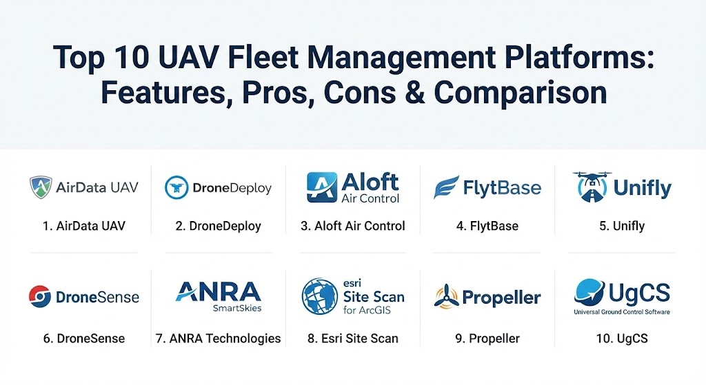
Top 10 UAV Fleet Management Platforms
1 — AirData UAV
AirData UAV is arguably the most data-centric platform in the industry, focused heavily on preventative maintenance and deep flight analytics. It automatically syncs flight data from dozens of different apps to provide a “health report” for every component in your fleet.
- Key features:
- Automatic flight log synchronization from over 60+ flight apps.
- Advanced battery health tracking (voltage, cycles, and temperature).
- Preventative maintenance alerts based on actual flight hours.
- High-resolution terrain and weather overlays for mission planning.
- Pilot proficiency and safety scoring based on flight telemetry.
- Robust compliance reporting for FAA, CAA, and EASA requirements.
- Pros:
- Unmatched depth in hardware health analytics; identifies issues before they cause crashes.
- Supports an incredibly wide range of hardware and third-party flight apps.
- Cons:
- The user interface is very data-heavy and can be overwhelming for beginners.
- Some of the most valuable analytics are locked behind higher-tier enterprise plans.
- Security & compliance: SOC 2 Type II, GDPR compliant, and SSO integration for enterprise teams.
- Support & community: Excellent technical documentation, responsive email support, and a large community of industrial pilots.
2 — DroneDeploy
DroneDeploy is the industry leader for mapping and reality capture, but its fleet management module has evolved into a powerhouse for coordinating large-scale inspection teams. It focuses on the “end-to-end” workflow, from flight to 3D model.
- Key features:
- Unified flight, fleet, and data processing platform.
- Automated flight planning for mapping and 3D reconstruction.
- Real-time “Live Stream” capabilities for remote command centers.
- Integrated project management for ground and aerial data.
- Enterprise-grade role-based access control (RBAC).
- AI-powered analysis for detecting defects in infrastructure.
- Pros:
- The most seamless transition from “flying” to “data analysis” in a single tool.
- Very polished, modern user interface that requires minimal training.
- Cons:
- High pricing relative to standalone fleet management tools.
- Heavily focused on mapping; might be overkill for teams only doing visual inspections.
- Security & compliance: ISO 27001, SOC 2 Type II, HIPAA (for specific data types), and encrypted cloud storage.
- Support & community: Dedicated account managers for enterprise clients, extensive webinars, and an active online forum.
3 — Aloft Air Control
Formerly known as Kittyhawk, Aloft is famous for its “compliance-first” approach. It is deeply integrated with the FAA’s LAANC system, making it the gold standard for organizations operating in complex or restricted airspace.
- Key features:
- One-tap LAANC airspace authorizations for near-instant flight approval.
- Dynamic airspace advisories with real-time NOTAMs and TFRs.
- Comprehensive fleet and pilot management with digital “Checklists.”
- Asset tracking for drones, batteries, and ground equipment.
- Incident reporting and risk assessment workflows.
- API-first architecture for integration with other enterprise software.
- Pros:
- The fastest and most reliable platform for ensuring legal airspace compliance.
- The mobile app is exceptionally responsive and designed for field use.
- Cons:
- Data analytics for hardware health are not as deep as AirData UAV.
- Feature updates sometimes focus more on regulatory tools than automation.
- Security & compliance: SOC 2, ISO 27001, and secure data handling protocols for government agencies.
- Support & community: Professional onboarding services, direct technical support, and extensive regulatory guides.
4 — FlytBase
FlytBase is the leading platform for the “Drone-in-a-Box” (DiaB) era. It is designed specifically for remote, autonomous operations where the pilot may be hundreds of miles away from the aircraft.
- Key features:
- Remote command and control via 4G/5G/Satellite links.
- Integration with major docking stations (DJI Dock, Hextronics, etc.).
- Automated precision landing using computer vision.
- BVLOS (Beyond Visual Line of Sight) mission orchestration tools.
- Multi-drone “swarm” and mission scheduling.
- Low-latency video streaming for remote security monitoring.
- Pros:
- The best solution for fully automated, remote-site surveillance.
- Extremely flexible API that allows for custom enterprise integrations.
- Cons:
- Very technical setup; requires a solid understanding of network configurations.
- Not designed for manual, ad-hoc photography or simple mapping.
- Security & compliance: End-to-end encryption, secure cloud hosting, and robust audit trails for remote missions.
- Support & community: Technical consulting, developer-centric documentation, and direct engineering support.
5 — Unifly
Based in Europe, Unifly is a leader in the Unmanned Traffic Management (UTM) space. It acts as a bridge between commercial drone operators and national aviation authorities.
- Key features:
- Advanced UTM integration for large-scale airspace coordination.
- Automated flight authorization and validation workflows.
- Real-time visualization of manned and unmanned air traffic.
- Management of “no-fly zones” and geofencing.
- Support for multi-national fleet operations under different regulatory bodies.
- Pros:
- Excellent for large enterprises operating across multiple countries (especially EU).
- Strongest integration with national air traffic control systems.
- Cons:
- The interface is designed for administrative oversight rather than field pilot ease-of-use.
- Limited focus on data processing or hardware health metrics.
- Security & compliance: High-level encryption, ISO-aligned security, and regulatory-grade audit logs.
- Support & community: Focused primarily on enterprise and government support; limited public community.
6 — DroneSense
DroneSense is the premier platform built specifically for Public Safety (Police, Fire, and SAR). It prioritizes real-time situational awareness and incident management over traditional data analytics.
- Key features:
- Real-time live streaming with sub-second latency for command staff.
- “Ops Center” for multi-drone coordination during emergency incidents.
- Comprehensive pilot and aircraft logbook for legal accountability.
- Hardware-agnostic control for DJI, Autel, and Parrot drones.
- Integrated hardware maintenance and battery tracking.
- Pros:
- Best-in-class situational awareness for emergency response.
- Specifically built for the high-pressure environment of public safety.
- Cons:
- Premium pricing can be difficult for smaller agencies to justify.
- Less emphasis on photogrammetry or 3D mapping features.
- Security & compliance: CJIS (Criminal Justice Information Services) compliant, SOC 2, and secure encrypted streaming.
- Support & community: 24/7 support for critical agencies and a tight-knit community of public safety pilots.
7 — ANRA Technologies (SmartSkies)
ANRA Technologies provides a robust suite under the SmartSkies brand, focusing on mission orchestration and UTM for complex environments like urban air mobility and delivery.
- Key features:
- Mission orchestration for autonomous delivery fleets.
- Advanced deconfliction algorithms for high-density airspace.
- Seamless integration with Remote ID and electronic conspicuity.
- Support for heterogeneous fleets (drones and ground robots).
- Multi-site operational dashboards for global management.
- Pros:
- Forward-looking platform built for future “Smart City” logistics.
- Strong emphasis on automated safety and regulatory interoperability.
- Cons:
- Significant complexity; often requires custom implementation by ANRA engineers.
- Not intended for small-scale commercial surveying or mapping.
- Security & compliance: Enterprise encryption, audit logs, and adherence to international UTM standards.
- Support & community: White-glove service for enterprise partners; strong presence in global regulatory forums.
8 — Esri Site Scan for ArcGIS
For organizations already using the ArcGIS ecosystem, Site Scan is the logical choice. It is a cloud-based drone mapping software that includes fleet management and compliance as a core component.
- Key features:
- Direct integration with ArcGIS Online and ArcGIS Pro.
- Automated mission planning for complex 3D structures.
- Comprehensive pilot and fleet management for GIS departments.
- Automated data processing into high-accuracy 2D and 3D products.
- Fleet-wide usage and compliance dashboards.
- Pros:
- Unrivaled integration with spatial data workflows and GIS databases.
- Trusted by government and engineering firms already using Esri products.
- Cons:
- High barrier to entry if you are not already an ArcGIS user.
- Fleet management features are tightly coupled with the mapping workflow.
- Security & compliance: SOC 2 Type II, FISMA, and advanced user authentication (SSO).
- Support & community: Backed by the global Esri support network and a massive GIS community.
9 — Propeller
Propeller is a specialized platform for heavy industries—specifically construction, mining, and waste management. It simplifies fleet management by focusing on data accuracy and site progress.
- Key features:
- Simplified data processing with high-accuracy AeroPoints (ground control).
- Site-wide visibility for all stakeholders (Project Managers to Foremen).
- Integrated pilot and fleet tracking for earthworks projects.
- Automated volume calculations and cut/fill analysis.
- Fleet health and compliance monitoring for industrial sites.
- Pros:
- Exceptional customer support that assists with data processing.
- The most accurate tool for topographic surveys in mining and construction.
- Cons:
- Narrow focus on earthworks; not suitable for agricultural spraying or SAR.
- Subscription costs are relatively high for smaller construction firms.
- Security & compliance: Secure cloud storage, data access controls, and SOC-aligned practices.
- Support & community: Dedicated customer success teams and proactive data processing support.
10 — UgCS (Universal Ground Control Software)
UgCS is a technical powerhouse preferred by industrial pilots who need advanced 3D mission planning, such as terrain following and LiDAR scanning in remote areas.
- Key features:
- Advanced 3D mission planning with terrain following (from SRTM data).
- Support for specialized sensors (LiDAR, Magnetometers, GPR).
- Multi-drone mission management from a single station.
- Offline maps and missions for remote, disconnected environments.
- Customizable telemetry and video streaming.
- Pros:
- Allows for total data sovereignty with offline local storage options.
- Best-in-class for technical missions (e.g., magnetic surveys).
- Cons:
- Steep learning curve; the interface is professional and complex.
- Less emphasis on the “administrative” side of fleet management (checklists/logs).
- Security & compliance: Varies—allows for complete local/private deployment for maximum security.
- Support & community: Strong documentation and a technical community of industrial pilots.
Comparison Table
| Tool Name | Best For | Platform(s) Supported | Standout Feature | Rating (Gartner / Review) |
| AirData UAV | Hardware Health | iOS, Android, Web | Preventative Maintenance Alerts | 4.7 / 5 |
| DroneDeploy | Mapping Teams | iOS, Android, Web | In-app 3D Data Processing | 4.6 / 5 |
| Aloft Air Control | Compliance | iOS, Android, Web | One-tap LAANC Authorizations | 4.8 / 5 |
| FlytBase | Autonomous Fleets | Web, Linux (Edge) | Remote “Drone-in-a-Box” Control | 4.5 / 5 |
| Unifly | UTM & Regulatory | Web, Mobile | National Airspace Integration | N/A |
| DroneSense | Public Safety | iOS, Android, Web | Sub-second Live Streaming | 4.9 / 5 |
| ANRA SmartSkies | Urban Mobility | Web, Cloud | UTM & Delivery Orchestration | N/A |
| Esri Site Scan | GIS Departments | iPad, Web | Native ArcGIS Integration | 4.4 / 5 |
| Propeller | Earthworks/Mining | Web | Data Accuracy & AeroPoints | 4.8 / 5 |
| UgCS | Technical Surveys | Windows, macOS, Linux | 3D Terrain Following | 4.5 / 5 |
Evaluation & Scoring of UAV Fleet Management Platforms
To help you decide, we have evaluated these platforms across several key performance indicators. Note that the “best” score in one category might not matter if it fails in the category most important to your specific industry.
| Category | Weight | Evaluation Criteria |
| Core Features | 25% | Flight logging, maintenance tracking, and airspace authorization tools. |
| Ease of Use | 15% | Intuitiveness for field pilots and training time required for new admins. |
| Integrations | 15% | Compatibility with major hardware (DJI/Autel) and enterprise software (GIS/ERP). |
| Security & Compliance | 10% | Encryption standards, SOC 2 status, and regulatory reporting depth. |
| Performance | 10% | Stability, speed of data synchronization, and mobile app reliability. |
| Support | 10% | Quality of documentation, speed of help desk, and onboarding services. |
| Price / Value | 15% | ROI for the organization relative to the recurring subscription costs. |
Which UAV Fleet Management Platform Tool Is Right for You?
Solo Users vs SMB vs Enterprise
- Solo Users: If you are a single pilot, you likely don’t need a full platform. Use AirData UAV (Free tier) for logs or the free Aloft app for LAANC approvals.
- SMBs: Smaller teams should prioritize ease of use and price. Aloft Air Control and AirData offer great mid-tier plans that cover compliance without breaking the bank.
- Enterprise: Large corporations need DroneDeploy or Esri Site Scan to integrate aerial data into their existing business intelligence workflows.
Budget-Conscious vs Premium Solutions
- Budget: JSCAPE or AirData‘s lower tiers provide essential compliance at an affordable price.
- Premium: DroneDeploy and DroneSense represent higher price points but offer significant time savings through automation and specialized features.
Feature Depth vs Ease of Use
- Feature Depth: UgCS and AirData offer the most control and data, but require more technical skill.
- Ease of Use: Aloft and DroneDeploy have polished, user-friendly interfaces that allow teams to get up and running in days.
Frequently Asked Questions (FAQs)
1. What exactly is a UAV fleet management platform? It is a software system that tracks your drones, pilots, and flight data in one place to ensure safety, legal compliance, and operational efficiency across multiple aircraft.
2. Can these platforms prevent my drone from crashing? Not directly during flight, but platforms like AirData UAV analyze telemetry to find hardware “red flags” (like failing motors or battery cells) so you can ground the drone before it crashes.
3. Do these platforms work with all drone brands? Most support DJI and Autel, but “hardware-agnostic” platforms like DroneSense or UgCS offer broader support for custom or less common drone brands.
4. How does LAANC work within these tools? Tools like Aloft are directly connected to the FAA’s system. You select your flight area, and the software instantly verifies if you can fly and submits your request to the FAA.
5. Are these tools secure for government use? Yes, several platforms like DroneSense and Aloft are built with CJIS or SOC 2 compliance specifically to meet the strict security requirements of government and law enforcement agencies.
6. Do I need an internet connection to use them? Most require an internet connection for real-time tracking, but platforms like UgCS allow for offline mission planning and data storage in remote areas.
7. Can these tools help with BVLOS flights? Yes, platforms like FlytBase and ANRA include specific modules for Beyond Visual Line of Sight missions, including traffic deconfliction and remote telemetry.
8. How do these tools track battery health? They read the detailed logs from the drone’s smart battery, tracking every charge cycle, cell voltage deviation, and temperature spike over the life of the battery.
9. Can I integrate drone data into my existing company software? Most enterprise platforms offer APIs that allow you to push flight logs or data products directly into your ERP, CRM, or GIS (like ArcGIS) systems.
10. What is the biggest mistake when choosing a platform? Buying “too much” software. SMBs often buy expensive mapping suites when all they really needed was a simple compliance log and airspace tool.
Conclusion
Selecting a UAV fleet management platform in 2026 is no longer about choosing the “coolest” app; it’s about choosing the most reliable operational partner. Whether your priority is technical mapping accuracy with Propeller, legal compliance with Aloft, or public safety response with DroneSense, the right platform acts as the foundation of a safe and profitable drone program. Remember: the best tool is the one that your pilots will actually use in the field every day.